
08: The Queen
Cycling across Japan Days 13 and 14: Nakatsugawa to Matsumoto, Matsumoto to Nozawa Onsen.

Hello! It’s hard to believe, but we are now at the halfway point of our cycle and making rapid progress towards Wakkanai, pulling back to back 120km days. If you know someone who’d enjoy following along with the rest of our journey, please share this newsletter with them. And if there are any parts of the trip you’d like to know more about, please let me know in the comments below. Thank you,
Day 13 (Nakatsugawa to Matsumoto - 120km)
Every morning at 6 am, Tom’s alarm goes off, a cacophony of raucous bird noise. Wax earplugs wedged deep inside his skull, eye mask on, he sleeps through. I call to him, “Tom, Tom! Your alarm is going off.” He sleeps on. Eventually I give him a friendly jab in the ribs. He mutters something about Marcus Aurelius and wanting to “be the experience.” Some people think about the Roman Empire too much. “The Sheet, The Sheet,” he groans. A bad dream, perhaps.
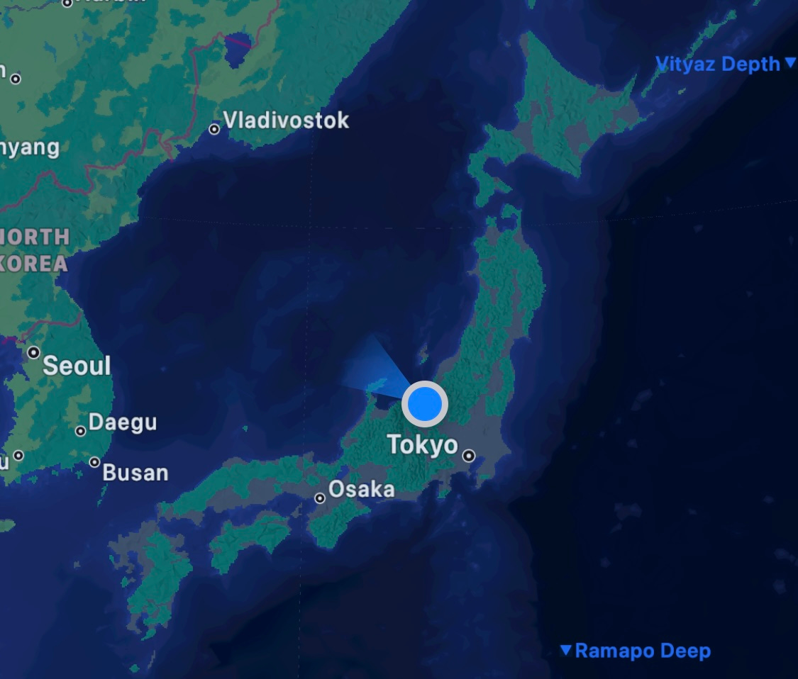
As we wrap up our second week of cycling, this little ritual has become our morning routine. I’m short on sleep, Tom has sore ribs, everyone’s a winner. We’ve pedalled well over 1,000 kilometres now, and have reached the halfway mark of our grand tour. On a map, we are now equidistant between our start point in southern Kagoshima, and our end point in northern Hokkaido. So close, so, so far.
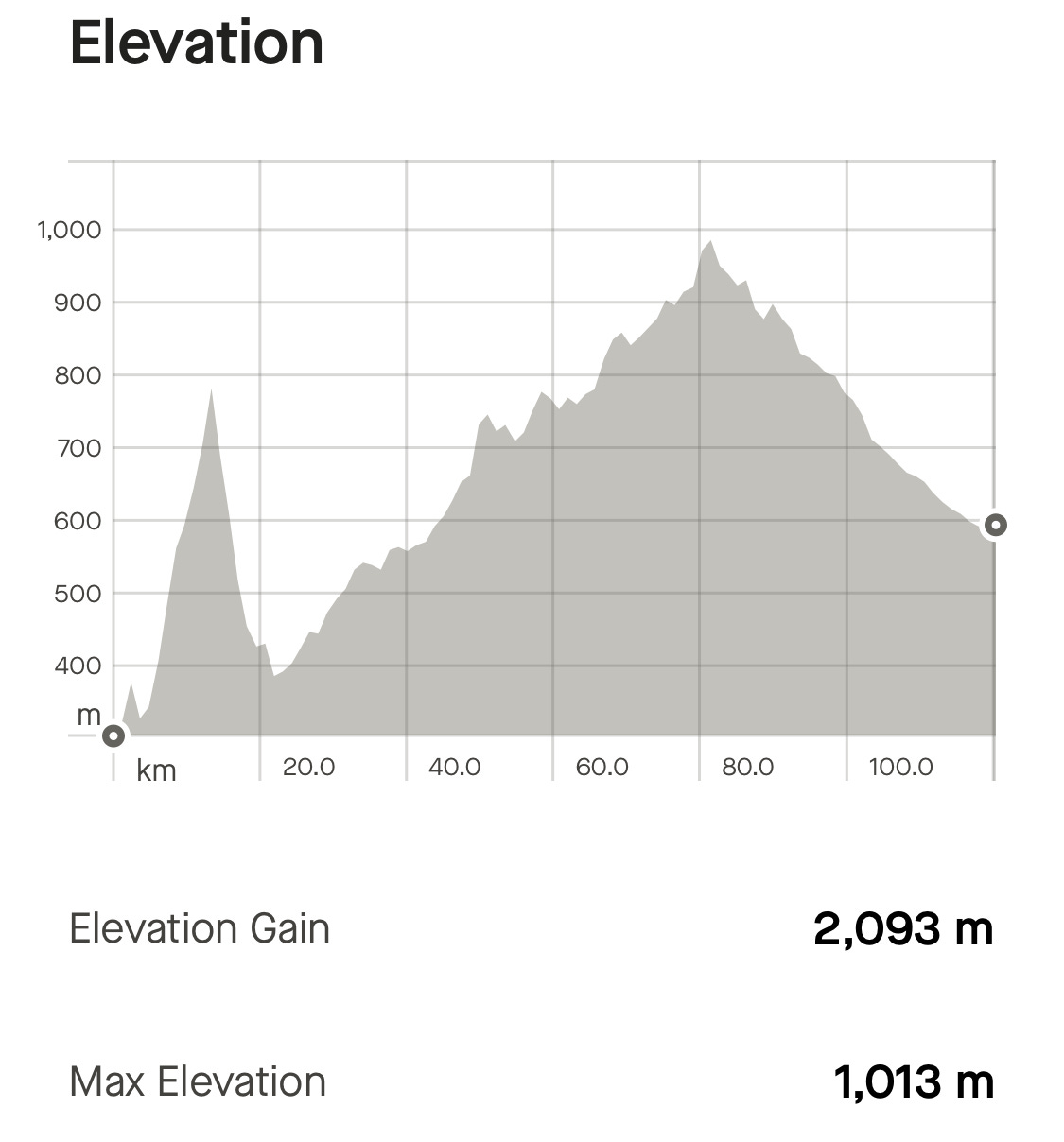
In the Tour De France each year, the longest, toughest, most gruelling stage is dubbed the Queen Stage. Day 13 was our Queen Stage: Nakatsugawa to Matsumoto, 120km horizontal, over 2,000 meters vertical. On The Sheet, there is no day that is more difficult — though the cold weather and fickle winds of Hokkaido might test the theory.
Our route traced a long section of the Nakasendo, the historic corridor that linked Tokyo to Kyoto via the mountainous interior. Back in its heyday during the Edo Period (1603-1868), the Nakasendo was one of the country’s five main highways. It had 67 post towns spread along its 540km length so that travelling lords and their entourages could safely spend the night en route. A handful of these post towns have been extraordinarily well-preserved, with strict rules in place to stop inhabitants selling their land to developers, or trying to turn their Edo period buildings into eight-story super hotels. Magome and Tsumago are prime examples, their main thoroughfares lined with centuries old wooden houses, shops and shrines. While many towns boast of having a couple of buildings that date back to the Edo Period, few have escaped modern development in the way these two villages have.
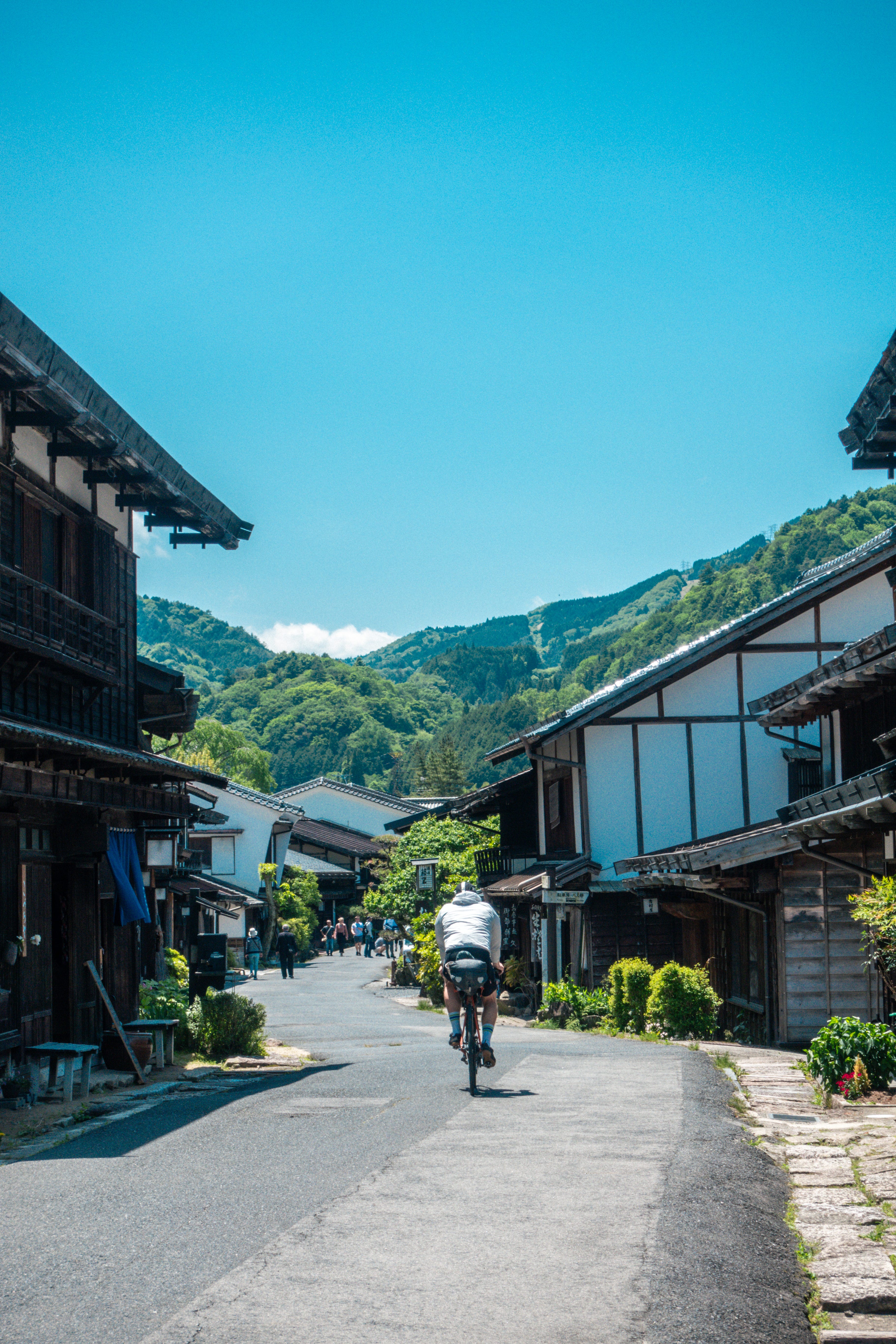
When we arrived in Magome, it was in the company of 200 highschoolers on a school trip, who whooped and cheered as we pedalled up the steep, cobbled streets (Tour of Flanders, eat your heart out). Much of the rest of the Nakasendo has been incorporated and expanded into modern (car friendly) highways, but here again Magome and Tsumago have triumphed over the usually unstoppable force of Japan’s construction industry. About 7 kilometres of the original path remains mostly intact, climbing steeply between the two towns. In another era, this route would have been packed with people making the two-week journey between Tokyo and Kyoto. Now it is the realm of hipster coffee shops, tourists, and a couple of very sweaty cyclists.
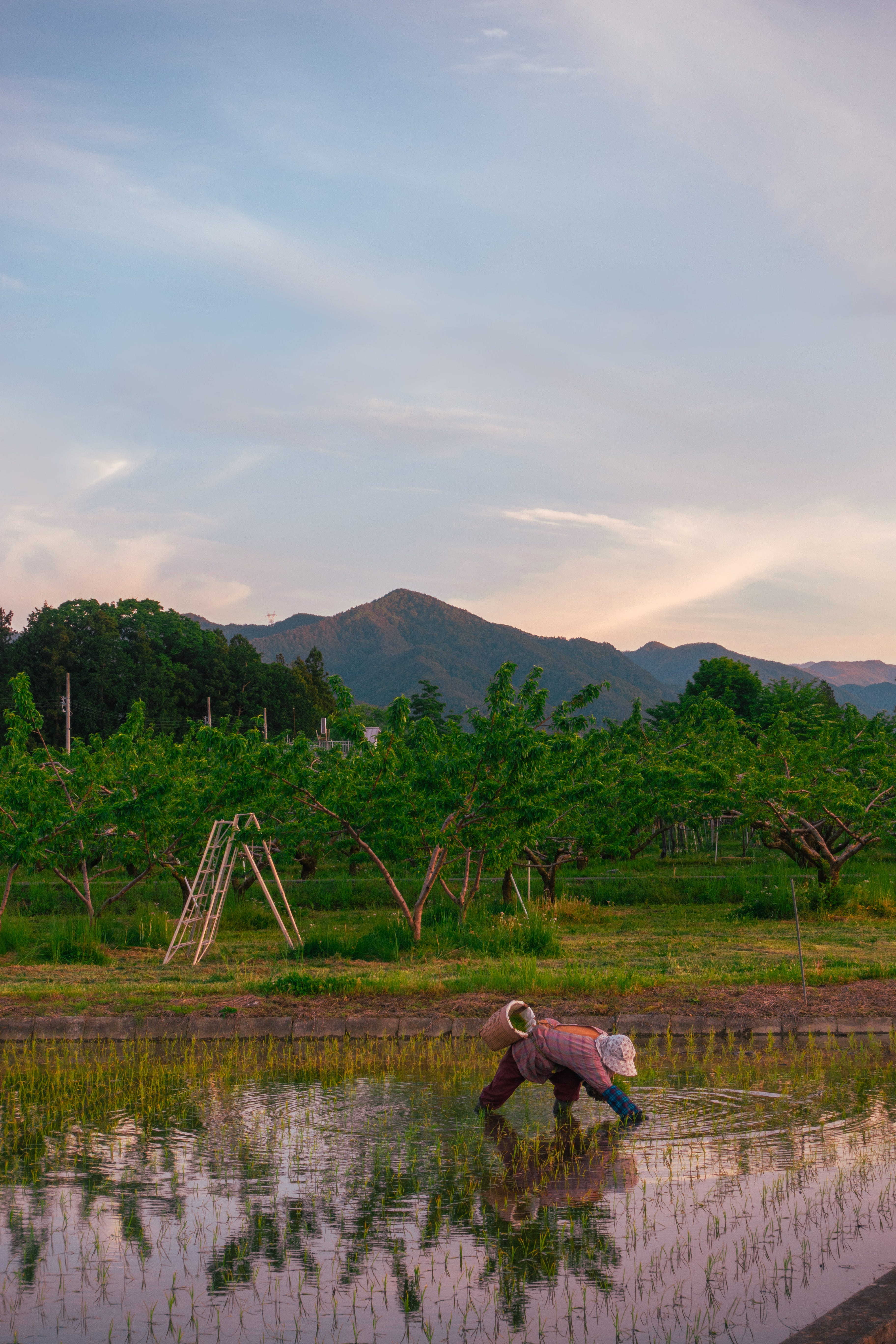
From Tsumago, we climbed for the next 60 kilometres through the Central Japanese Alps, following the Kiso River ever higher. Almost 75% of Japan is mountainous and we are no longer strangers to long climbs, but this was by far the longest of the trip. The landscape was serious, and the climbing with it. In the far distance we could see the snowcapped peaks of the Northern Alps, shimmering white against the blue sky. Rising to above 3,000 meters, these are home to some of Japan’s best hiking and skiing, while the valleys beneath them secret away quiet onsen towns and shrines. It was a long slog of a day, the climbing broken only by a late afternoon triple helping of noodles.
For the next hour, as I digested lunch and grew increasingly dehydrated under the May sun, I felt like I was going to fall asleep on my handlebars. I almost begged Tom for a break so I could nap at the side of the road — just for a moment, I promise. A well-placed vending machine saved the day, the red CocaCola sign on its top guiding me in like a moth to a flame. At last, 80km into the ride, we crested the final peak and begun a long, rolling descent into Matsumoto, skimming through the rice paddies as golden hour descended.
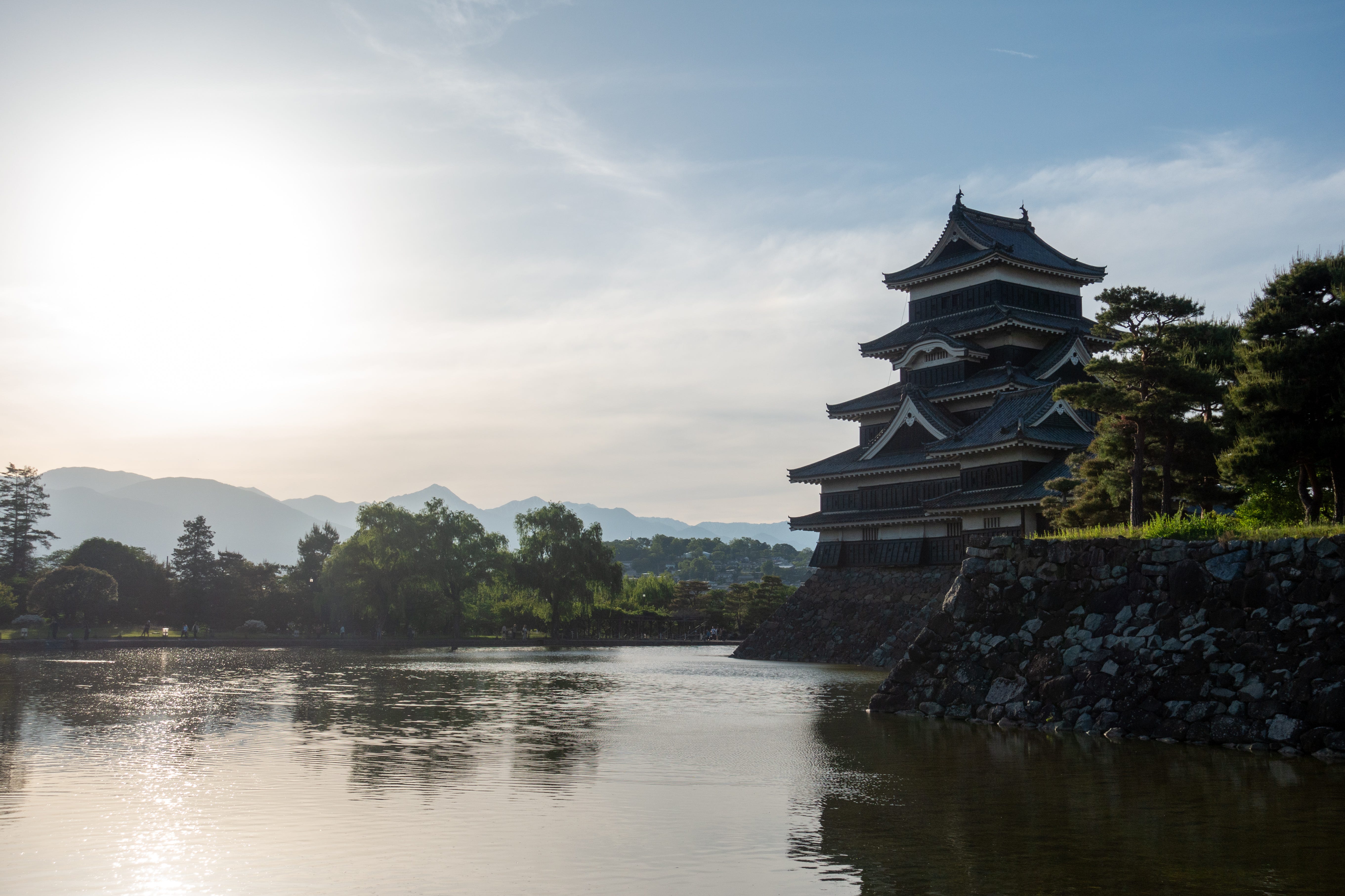
We made it to the city just as the sun was setting behind Matsumoto Castle, and met up with my good pal Francesco Bassetti for dinner and drinks (our first since starting the cycle). The next day was our only rest day, and we could afford to relax.
Rest Day - Norikura (0km)
Nagano Prefecture is famous for soba noodles, made from buckwheat flour (the same type that goes into a French galette) and the nutrient-rich mountain water that melts from the winter snowpack. The best time to eat soba is May, when they’ll be served with a side of tempura sansai, foraged mountain vegetables.
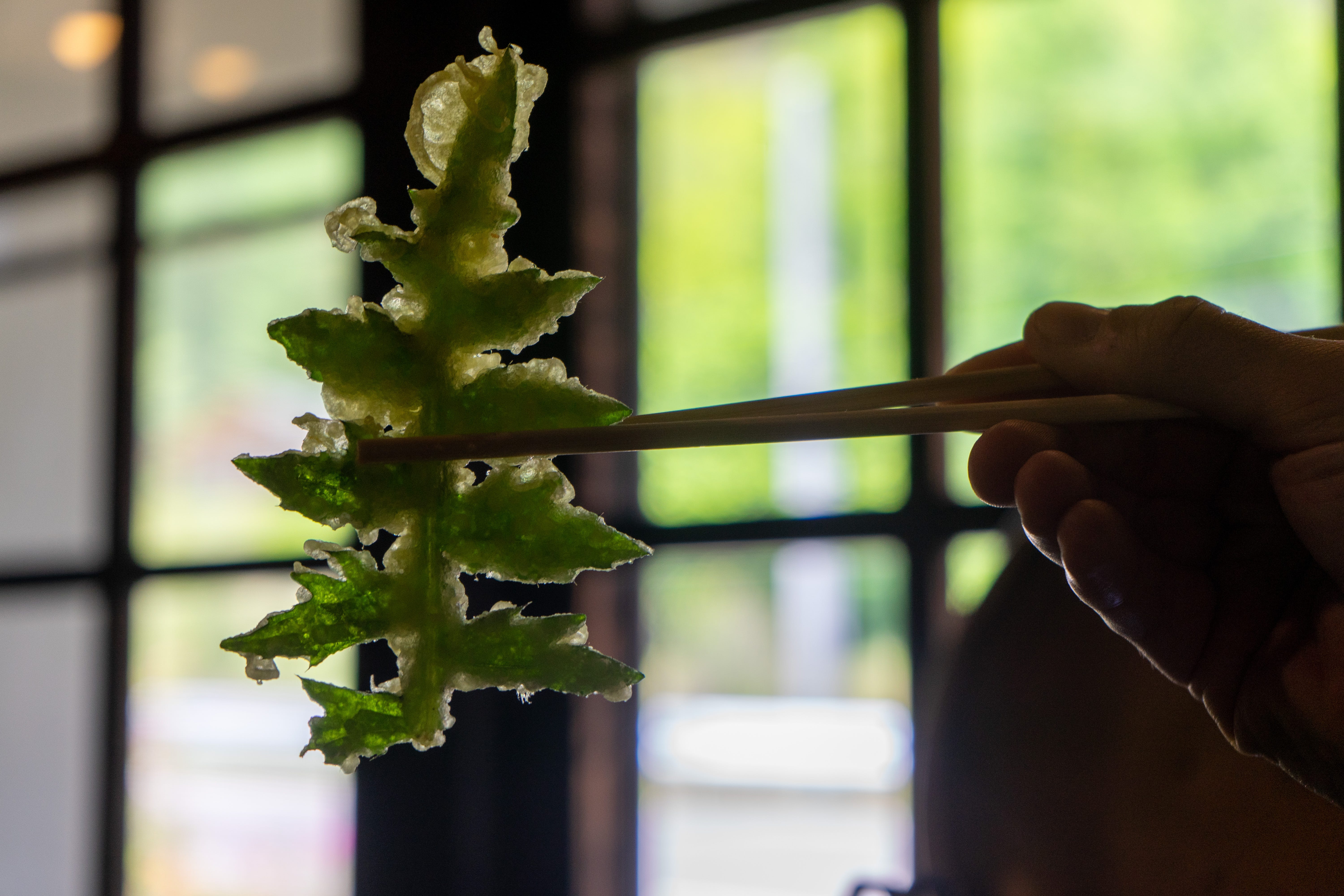
For our rest day, Francesco suggested we go waterfall hunting near Mount Norikura, which took us past one of my favourite mountain haunts: Soba House Gasho. Coincidentally, I’d taken Tom to this spot when he’d visited me in Tokyo two years earlier. We made it by 11.30, just in time to beat the lunchtime rush, yet not fast enough to escape the queue outside the already fully-seated restaurant. The noodles are handmade in house and when they run out the shop closes for the day. When we sat down to eat, the noodles were served cold (a good thing in the warmer months) on a wicker basket, with a dipping sauce and side of the fabled mountain vegetable tempura. All for the lowly price of ¥1,500 (£7.50). Unbeatable.
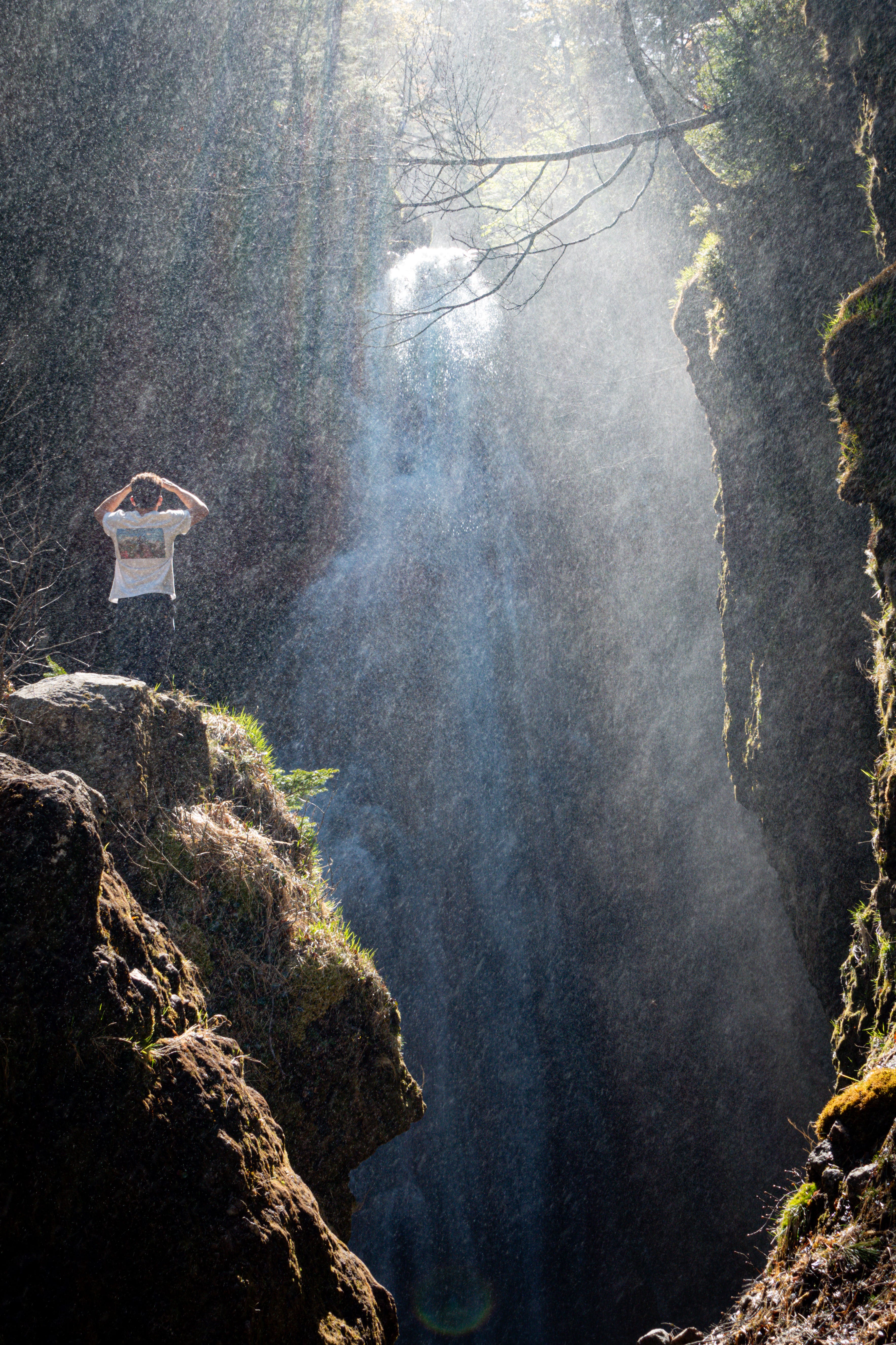
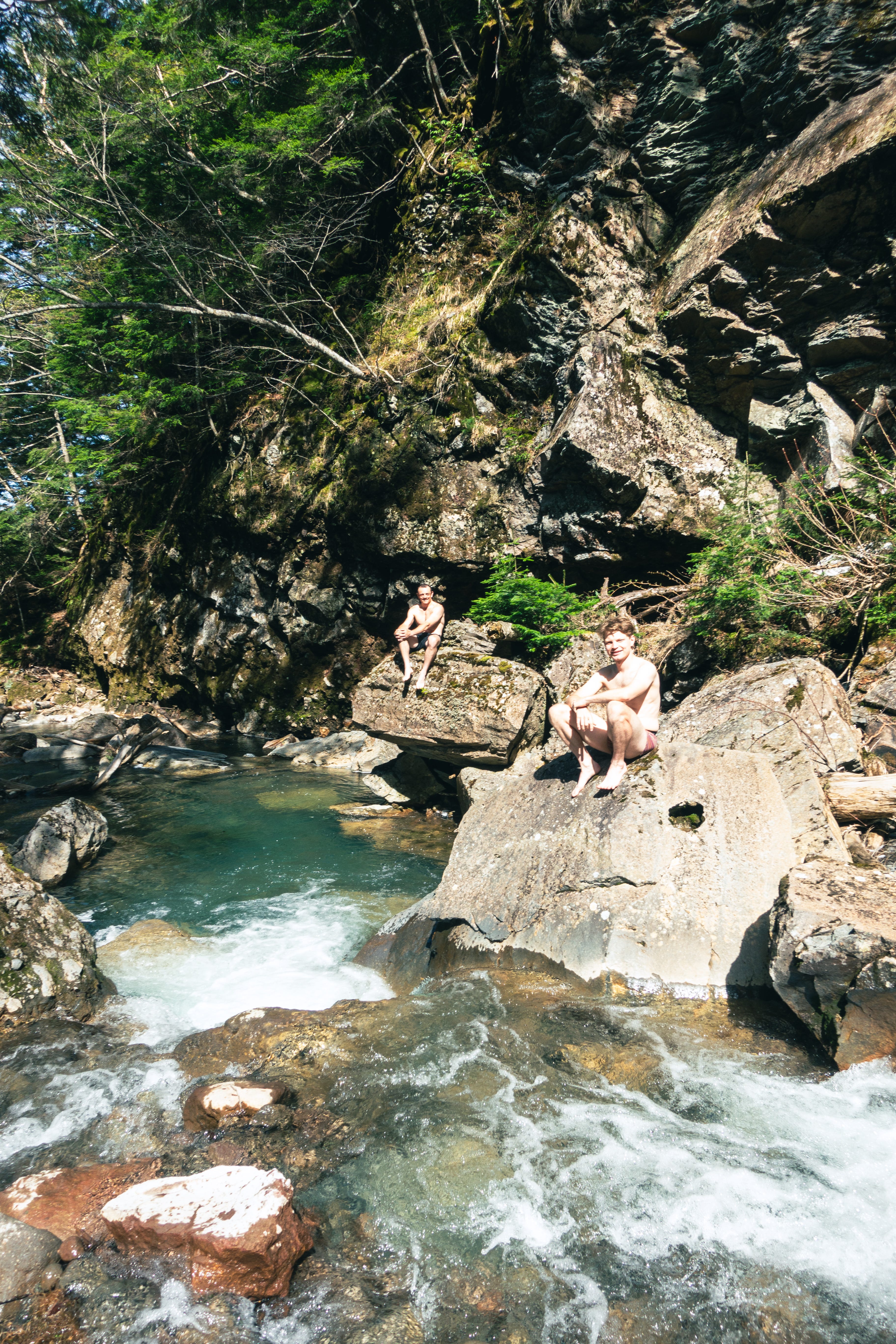
From Gasho, a short drive and a shorter hike took us to Sanbondaki, three huge waterfalls arranged in a semi-circle in a natural amphitheater. It was exactly how I wanted to spend the rest day: out in the wild with two good mates, swimming in the snowmelt beneath one of the most beautiful waterfalls I’ve ever seen.
Day 14 - Matsumoto to Nozawa Onsen (123km)
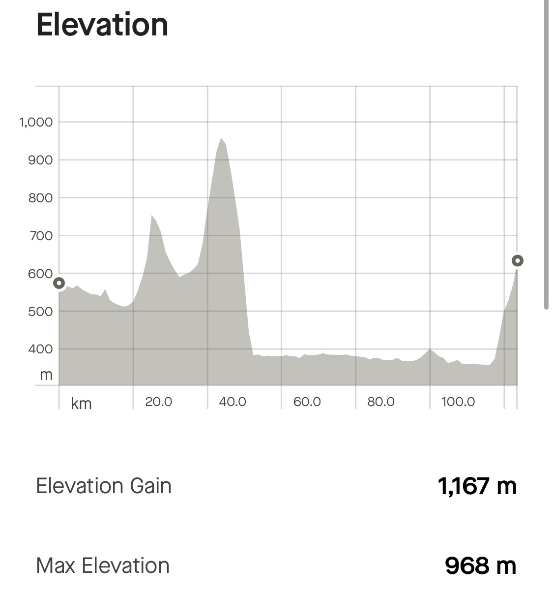
To complete our Alpine odyssey, we took the mountain road out of Matsumoto to Nozawa Onsen, one of the ski villages to host the 1998 Winter Olympics. It was another long day of climbing in the shadow of the Northern Alps and any benefits of the rest day wore off in about five minutes on the up. Around us, the architecture of houses began to change, adopting steeper roofs to fend off the winter snow and long chimneys for their log burners. The trees too began to thin, and we were treated to a regalia of mountain flowers in full bloom. It all felt a very long way from the humid slopes of Mount Kaimon, where we started our ride.
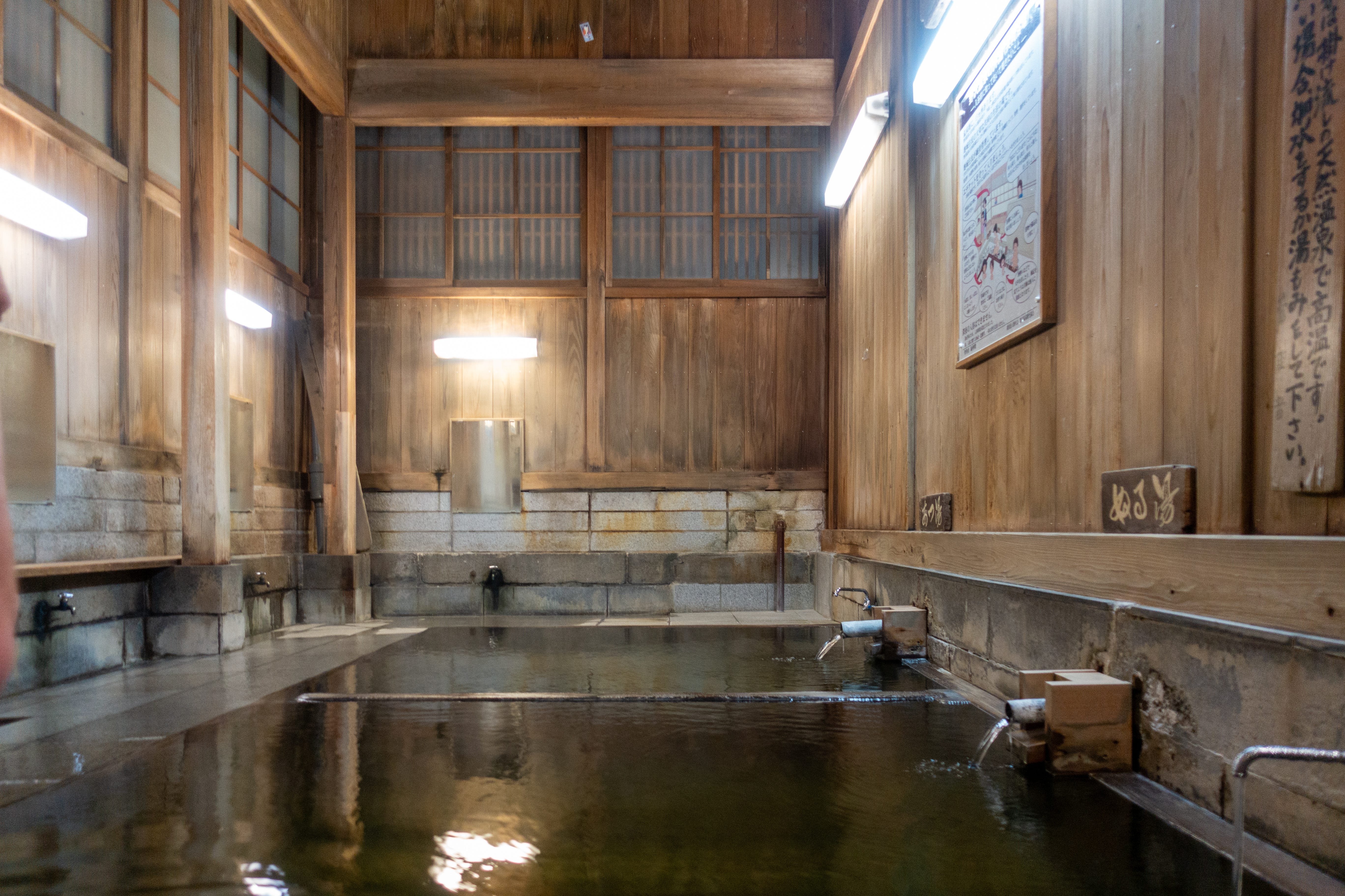
From the mountains we descended once more to the valley floor, and followed the Chikuma River 60 kilometres north, before one last climb to Nozawa Onsen. You can smell Nozawa before you can see it. The village is built atop a rich seam of hot water, and the air is thick with the sulphur it carries with it. Fourteen baths in the village are freely accessible to the public, though many are unbearably hot, reaching up to 60C. Those are the domain of wrinkled old men whose rhinoceros-like skin lost its ability to feel heat sometime in the late 1990s. I’m found cowering beneath the cold tap, where the water is a more tolerable 48C.
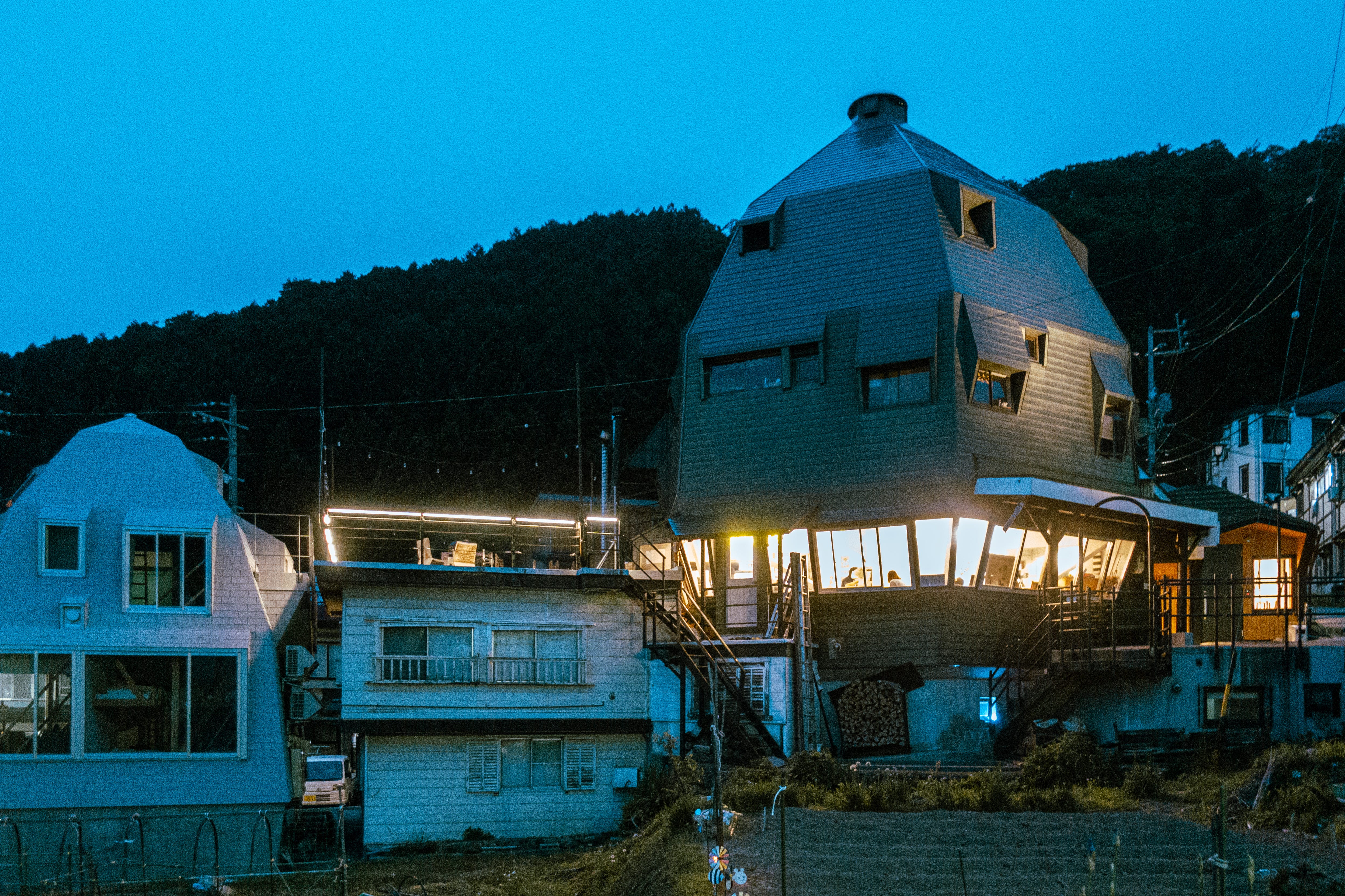
Our home for the night: Nozawa Lodge, the great space egg designed by architect/mountaineer/Le Corbusier apprentice Yoshizaka Takamasa in the 1960s. It is one of the few buildings that predates the modern ski resort and is much older than any of the current lift infrastructure. Like Tsumago and Magome, the old Edo post towns, the lodge has survived the forces of modern development, despite the best ambitions of previous owners to demolish it for something newer. I, for one, am glad it has.
Thank you for reading, and for following our cycle,
Oscar
Stats
Day 13: Nakatsugawa to Matsumoto
Distance: 120.46 km
Vertical: 2,093m
Day 14: Matsumoto to Nozawa Onsen
Distance: 123.67km
Vertical: 1,167m
Total
Distance: 1,326km
Vertical climbed: 13,986m
Onigiri eaten: 29
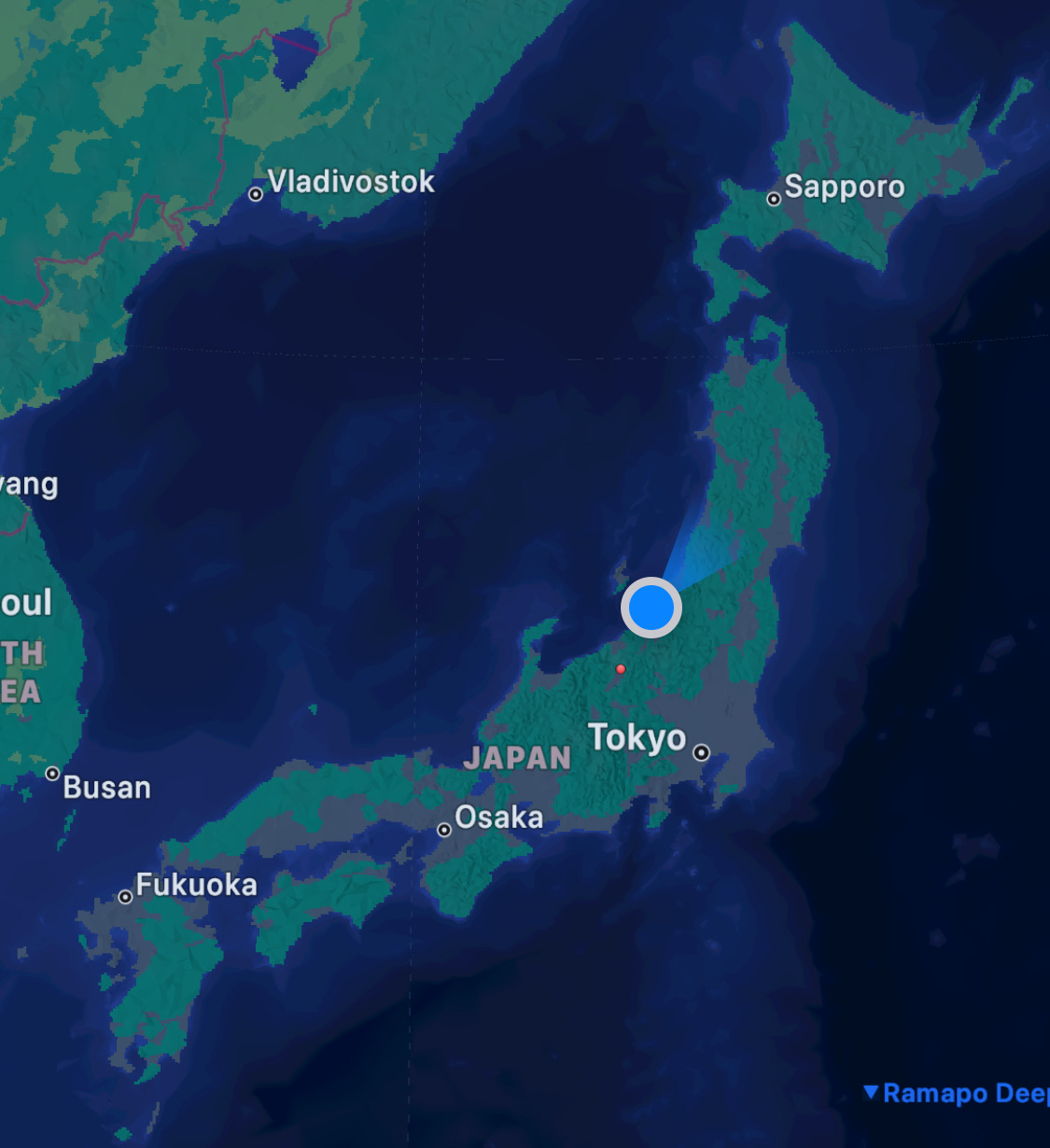
Current location: Sanjo
Stunning and well done for passing half way. But sad to be nearer the end than the beginning. I hope it does not pass by too quickly. X